Searching for locations: The remnants of the wall that surrounded Beijing, China

The fortification walls, both an inner wall and an outer wall, surrounding Beijing city were built from the early 1400s to 1553.

The dimensions of the Inner city wall are:
          Length: 24 kilometers or 15 miles
          Height: 25 meters or 49 feet high
          Thickness, at ground level: 20 meters or 66 feet
                            at the top: 12 meters or 29 feet

It had nine gates.  The fortifications included gate towers, archways, watchtowers, barbicans, barbican towers, sluice gates, sluice gate towers, enemy sighting towers, corner guard towers, and a moat system.

The outer city wall had a length of 28 kilometers or 17 miles.

From 1911, after the collapse of the Qing Dynasty, the dismantling of the fortifications began.

In 1965, major deconstruction of the fortifications was commenced to allow for the construction of the 2nd wrong road, and Line 2 or the Beijing underground railway.

 In 1979, the government called off the demolition of the remaining city walls and named them cultural heritage sites. By this time, the only intact sections were the gate tower and watchtower at Zhengyangmen, the watchtower at Deshengmen, the guard tower at the southeast corner, the northern moats of the Inner city, the section of the Inner city wall south of the Beijing railway station, and a small section of Inner-city wall near Xibianmen.

For more reading, go to: https://en.wikipedia.org/wiki/Beijing_city_fortifications

As for our guide’s explanation of the fortifications: Leaving the Square to go to the Golden Mask Dynasty Show, we pass remnants of the wall that used to surround Beijing.

This wall was built in the early 15th century and was about 24 km long, up to 15 meters high and about 20 meters thick, and had nine gates, one of which still exists today.  In 1965 most of it was removed so that the second ring road and an underground railway line could be built.

Searching for locations: The Forbidden City, Beijing, China

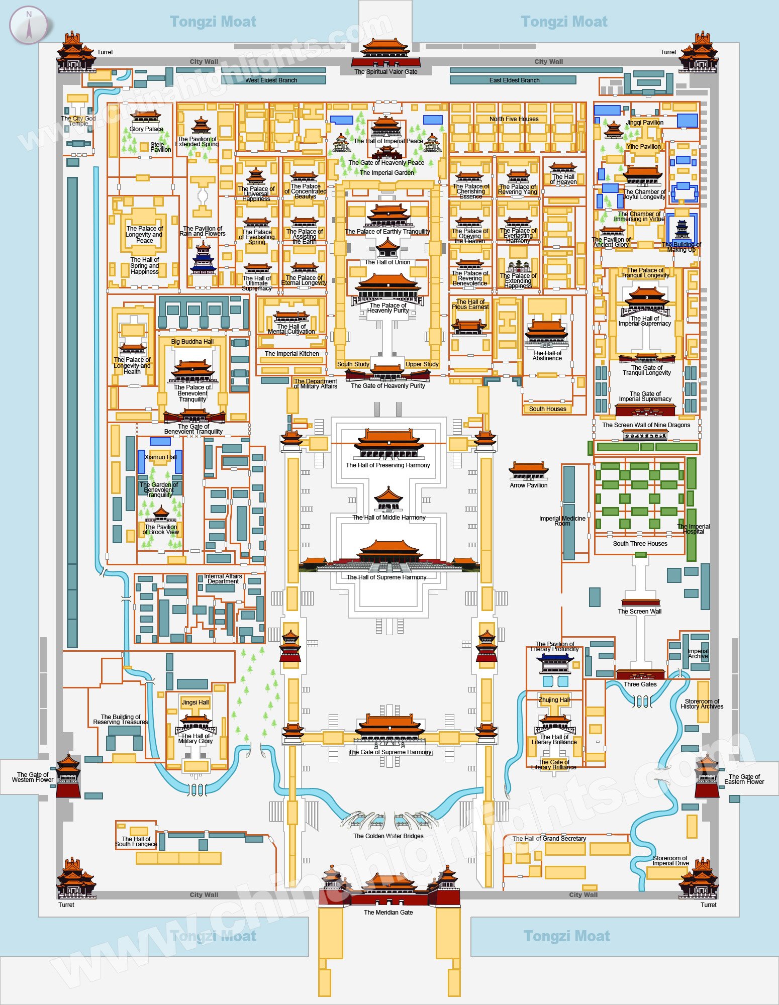
Now we’re walking to the Forbidden City, and it seems like we’re walking for miles and we’re practically exhausted before we get started on the main tour.  I’m not sure if we received a map of the city, but one is certainly needed so that you can navigate the many features, buildings, and walkways.
There are tour groups everywhere in the large courtyard outside the gate, most likely getting a lecture on the last of the Chinese emperors about that time Sun Yat-Sen proclaimed the new China around 1912.  We were no exception, and it was an interesting way to spend the time waiting to get in.  It was a tale of intrigue, interwoven with a 3-year-old emperor, and a scheming concubine who becomes the Emperor’s favorite, enough to bear him a son and successor.

Bribery and corruption at its best.

But its history runs something like this:

The Forbidden City is was once the imperial and state residence of the Emperor of China, as well as the center of government, from the Ming Dynasty to the Qing Dynasty, or 1420 to 1924.

It was built from 1406 to 1420 when the Yongle Emperor moved the capital from Nanking to Beijing and consists of about 980 buildings, and 8,886 bays of rooms (not the 9,999 as prescribed in myth) and covers 180 acres.  Over the 14 years, a million workers used whole logs of wood from the jungles of southwestern China, marble from quarries near Beijing, specially made golden bricks from Suzhou

Since 1925 it has been a museum and is the largest number of preserved wooden structures in the world.

The city is surrounded by a wall 7.9 meters high, and a moat that is 6 meters deep and 52 meters wide.  A tower sits at each of the four corners.  Each side has a gate, the north is called the Gate of Divine Might, the south is called the Meridian gate.  East and west are called East Glorious Gate and West Glorious Gate respectively.

But, back in the courtyard, we are ready to go in and follow the tour guide who has switched from her amplified microphone to a whisper device we all wear in our ears.  She talks and we listen.

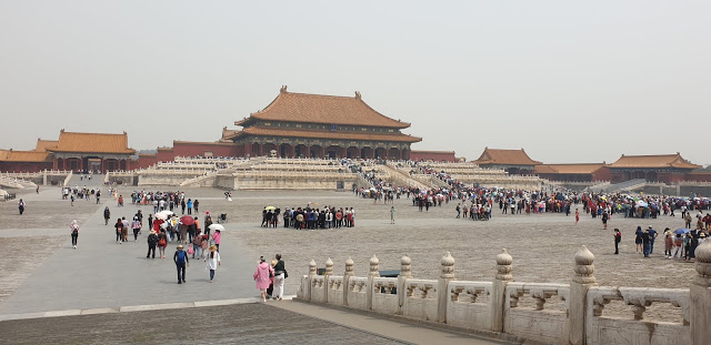
We all make it through and regroup on the other side. This is where the fun begins because we are about to meet a large percentage of the 80,000, they let for the day.
It seems to me they have all arrived at the same time, although by the time we get to the entrance gate, it is very well organized, bags are scanned, people are scanned, and you’re in.

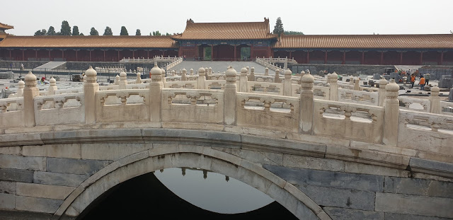
After crossing one of the seven Golden Water bridges, you begin to get some idea of the size and scope of the City, and in the distance, the first of the buildings, The Gate of Supreme Harmony.  On a hot day, that could be a long and thirsty walk.
From there it is one pagoda after another with buildings that surround the edge of the whole Forbidden City, as does the moat.

By the time we get to the second courtyard, it was time to have ice cream as a refresher.  Others head up to another exhibit, and it’s just too many stairs for us.

After this, it’s a walkthrough another courtyard, heading up and down some more stairs, we go and see the museum, with priceless relics from past emperors.
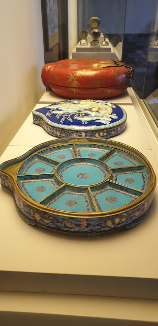
There are areas like the outer courtyard, the inner courtyard, yet another courtyard, and the gardens where the concubines walked and spent their leisure time.  It is not far from the emperor’s wives living quarters, though there’s precious little left of the furniture, other than a settee and two rather priceless so-called Ming dynasty vases.

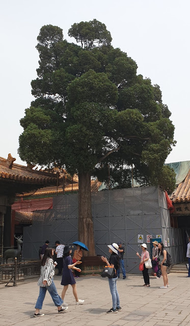
We get into the bad habit of calling all of the vases Ming dynasties.  Above is one of the inner courtyards there were living quarters, and that tree is over 300 years old.
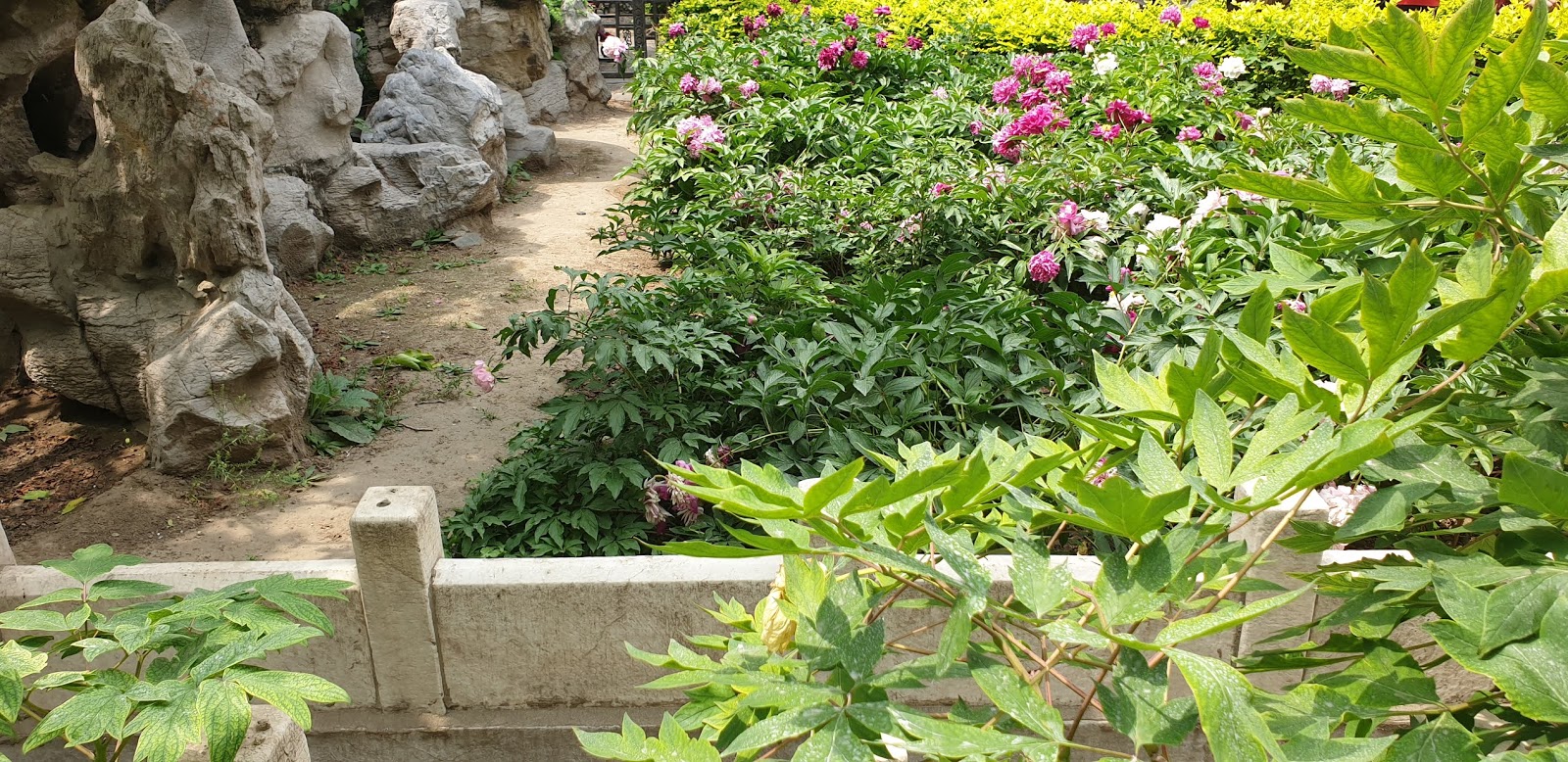
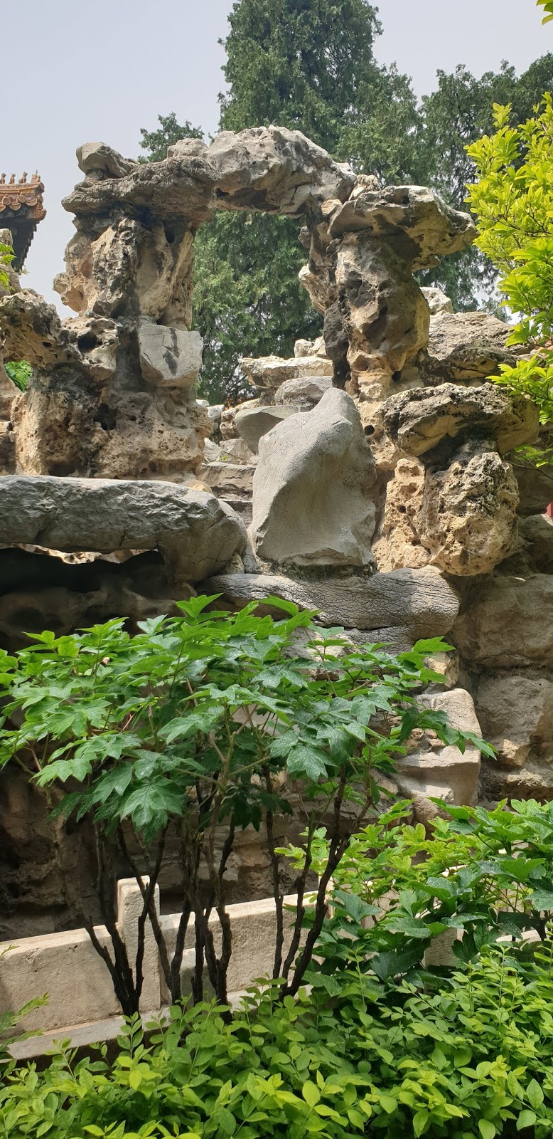
Out through some more alleyways and through an entrance that led to the area where the concubines lived, very spacious, bright, and filled with trees, plants, and walkways through rocky outcrops.

The whole area was made up of living quarters and waterways, rocks and paths, all very neatly set out, and it looked to be a very good place to live.

This is an example of the living quarters, overlooking the gardens

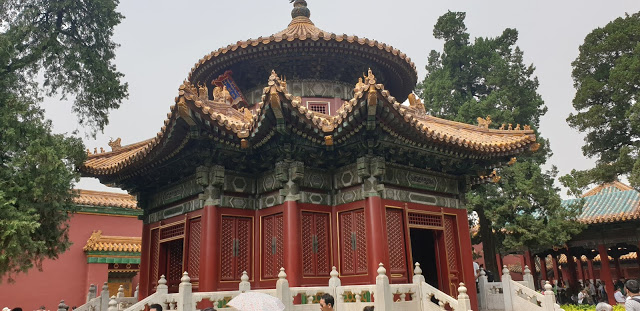
And there were several pagodas
From there its a quick exit out the northern entrance, and another longish walk to our bus, which arrives at the meeting point shortly after we do.

That done, the Beijing tour guide has completed her section of our China experience, and we’re ready to move onto the next.

Searching for locations: The Great Wall of China, near Beijing, China

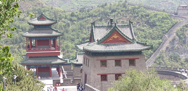
This is in a very scenic area and on the first impression; it is absolutely stunning in concept and in viewing.

As for the idea of walking on it, well, that first view of the mountain climb when getting off the bus, my first question was where the elevator is?  Sorry, there is none.  It’s walk on up or stay down the bottom.

Walk it is.  As far as you feel you are able.  There are quite a few who don’t make it to the top.  I didn’t.  I only made it to the point where the steps narrowed.

But as for the logistics, there’s the gradual incline to the starting point, and what will be the end meeting place.  From there, it’s a few steps up to the guard station no 7, and a few more to get up to the start of the main climb.  The top of the wall is guard station no 12.

Ok, those first few steps are a good indication of what it’s was going to be like and it’s more the awkwardness of the uneven heights of the steps that’s the killer, some as high as about 15 inches.  This photo paints an illusion, that it’s easy.  It’s not.

If you make it to the first stage, then it augers well you will get about 100 steps before you both start feeling it in your legs, particularly the knees, and then suffering from the height if you have a problem with heights as the air is thinner.  And if you have a thing with heights, never look down.

This was from where we stopped, about a third of the way up.  The one below, from almost at the bottom.  One we’re looking almost down on the buildings, the other, on the same level.

It requires rest before you come down, and that’s when you start to feel it in the knees, our tour guide called it jelly legs, but it’s more in the knees down.  Descending should be slow, and it can be more difficult negotiating the odd height steps, and particularly those high ones.  You definitely need to hang onto the rail, even try going backward.

And, no, that rail hasn’t been there as long as the wall.

While you are waiting for the guide to return to the meeting place at the appointed time, there should be time to have some jasmine tea.  Highly refreshing after the climb.

Searching for locations: The Forbidden City, Beijing, China

Now we’re walking to the Forbidden City, and it seems like we’re walking for miles and we’re practically exhausted before we get started on the main tour.  I’m not sure if we received a map of the city, but one is certainly needed so that you can navigate the many features, buildings, and walkways.

There are tour groups everywhere in the large courtyard outside the gate, most likely getting a lecture on the last of the Chinese emperors about that time Sun Yat-Sen proclaimed the new China around 1912.  We were no exception, and it was an interesting way to spend the time waiting to get in.  It was a tale of intrigue, interwoven with a 3-year-old emperor, and a scheming concubine who becomes the Emperor’s favorite, enough to bear him a son and successor.

Bribery and corruption at its best.

But its history runs something like this:

The Forbidden City is was once the imperial and state residence of the Emperor of China, as well as the center of government, from the Ming Dynasty to the Qing Dynasty, or 1420 to 1924.

It was built from 1406 to 1420 when the Yongle Emperor moved the capital from Nanking to Beijing and consists of about 980 buildings, and 8,886 bays of rooms (not the 9,999 as prescribed in myth) and covers 180 acres.  Over the 14 years, a million workers used whole logs of wood from the jungles of southwestern China, marble from quarries near Beijing, specially made golden bricks from Suzhou

Since 1925 it has been a museum and is the largest number of preserved wooden structures in the world.

The city is surrounded by a wall 7.9 meters high, and a moat that is 6 meters deep and 52 meters wide.  A tower sits at each of the four corners.  Each side has a gate, the north is called the Gate of Divine Might, the south is called the Meridian gate.  East and west are called East Glorious Gate and West Glorious Gate respectively.

But, back in the courtyard, we are ready to go in and follow the tour guide who has switched from her amplified microphone to a whisper device we all wear in our ears.  She talks and we listen.

We all make it through and regroup on the other side. This is where the fun begins because we are about to meet a large percentage of the 80,000, they let for the day.

It seems to me they have all arrived at the same time, although by the time we get to the entrance gate, it is very well organized, bags are scanned, people are scanned, and you’re in.

After crossing one of the seven Golden Water bridges, you begin to get some idea of the size and scope of the City, and in the distance, the first of the buildings, The Gate of Supreme Harmony.  On a hot day, that could be a long and thirsty walk.

From there it is one pagoda after another with buildings that surround the edge of the whole Forbidden City, as does the moat.

By the time we get to the second courtyard, it was time to have ice cream as a refresher.  Others head up to another exhibit, and it’s just too many stairs for us.

After this, it’s a walkthrough another courtyard, heading up and down some more stairs, we go and see the museum, with priceless relics from past emperors.

There are areas like the outer courtyard, the inner courtyard, yet another courtyard, and the gardens where the concubines walked and spent their leisure time.  It is not far from the emperor’s wives living quarters, though there’s precious little left of the furniture, other than a settee and two rather priceless so-called Ming dynasty vases.

We get into the bad habit of calling all of the vases Ming dynasties.  Above is one of the inner courtyards there were living quarters, and that tree is over 300 years old.

Out through some more alleyways and through an entrance that led to the area where the concubines lived, very spacious, bright, and filled with trees, plants, and walkways through rocky outcrops.

The whole area was made up of living quarters and waterways, rocks and paths, all very neatly set out, and it looked to be a very good place to live.

This is an example of the living quarters, overlooking the gardens

And there were several pagodas

From there its a quick exit out the northern entrance, and another longish walk to our bus, which arrives at the meeting point shortly after we do.

That done, the Beijing tour guide has completed her section of our China experience, and we’re ready to move onto the next.
Searching for locations: The Great Wall of China, near Beijing, China

This is in a very scenic area and on the first impression; it is absolutely stunning in concept and in viewing.

As for the idea of walking on it, well, that first view of the mountain climb when getting off the bus, my first question was where the elevator is?  Sorry, there is none.  It’s walk on up or stay down the bottom.

Walk it is.  As far as you feel you are able.  There are quite a few who don’t make it to the top.  I didn’t.  I only made it to the point where the steps narrowed.

But as for the logistics, there’s the gradual incline to the starting point, and what will be the end meeting place.  From there, it’s a few steps up to the guard station no 7, and a few more to get up to the start of the main climb.  The top of the wall is guard station no 12.

Ok, those first few steps are a good indication of what it’s was going to be like and it’s more the awkwardness of the uneven heights of the steps that’s the killer, some as high as about 15 inches.  This photo paints an illusion, that it’s easy.  It’s not.

If you make it to the first stage, then it augers well you will get about 100 steps before you both start feeling it in your legs, particularly the knees, and then suffering from the height if you have a problem with heights as the air is thinner.  And if you have a thing with heights, never look down.

This was from where we stopped, about a third of the way up.  The one below, from almost at the bottom.  One we’re looking almost down on the buildings, the other, on the same level.

It requires rest before you come down, and that’s when you start to feel it in the knees, our tour guide called it jelly legs, but it’s more in the knees down.  Descending should be slow, and it can be more difficult negotiating the odd height steps, and particularly those high ones.  You definitely need to hang onto the rail, even try going backward.

And, no, that rail hasn’t been there as long as the wall.

While you are waiting for the guide to return to the meeting place at the appointed time, there should be time to have some jasmine tea.  Highly refreshing after the climb.

Searching for locations: Taurangi, it’s an interesting town

Located at the bottom of Lake Taupo, in New Zealand, staying here would make more sense if you were here for the fishing, and, well, the skiing or the hiking, or just a relaxing half hour in the thermal pools.

I saw a sign somewhere that said that Taurangi was New Zealand’s premier fishing spot. I might have got the wrong, but it seems to me they’re right. On the other side of town, heading towards Taupo, there’s a lodge that puts up fly fishermen, and where you can see a number of them in an adjacent river trying their luck.

It’s what I would be doing if I had the patience.

But Taurangi is a rather central place to stay, located at the southernmost point of the lake. From there it is not far from the snowfields of Whakapapa and Turoa. Equally, at different times of the year, those ski fields become walking or hiking tracks, and the opportunity to look into a dormant volcano, Ruapehu.

It is basically surrounded by hills and mountains on three sides and a lake on the other. Most mornings, and certainly everyone is different, there is a remarkable sunrise, particularly from where we were staying on the lake, where it could be cloudy, clear, or just cold and refreshing, with a kaleidoscope of colors from the rising sun.

I don’t think I’ve been there to see two days the same.

However, Taurangi, on most days we’ve visited, is even more desolate than Taupo, both on the main street and the central mall. The same couldn’t be said for the precinct where New World, the local supermarket, a Z petrol station can be found. There it is somewhat more lively. The fact there’s a few more shops and a restaurant might help traffic flow.

There is also a mini golf course, and in the middle of winter, it is a bleak place to be, especially in the threatening rain, and the wind. It had also seen better days and in parts, in need of a spruce up, but it’s winter, and there are no crowds, so I guess it will wait till the Spring.

In the mall, there’s the expected bank, newsagent, gift shop and post office combined, and a number of other gift shops/galleries. But the best place is the café which I’ve never seen empty and has an extended range of pies pastries and cakes, along with the fast food staples of chips and chicken.
Oh, and you can also get a decent cup of coffee there.

There are two other coffee shops but we found this one the first time we came, we were given a warm welcome and assistance, and have never thought to go anywhere else, despite two known change of owners.

But despite all these reasons why someone might want to stay there, we don’t.

We have a timeshare, and there’s a timeshare in Pukaki called Oreti Village. That’s where we stay.

Searching for locations: Aratiatia Dam, Taupo, New Zealand

Aratiatia Dam water release, Taupo

The Aratiatia Dam, rapids, and hydroelectric power station are located on the Waikato River, New Zealand’s longest river.  It is about 16km from Taupo, and 6km from Huka falls, and there is a walking track, for the fit, of course, between the two water attractions.

This happens three or four times every day, depending on the season, and lasts about 15 minutes.  Water is released at the rate of about 80,000 liters a second, so it is quite a lot of water being sent through the rapids.

There are a number of viewing points, the most popular being from the bridge, where I took these photos, and 5 minutes down the walking track to the ridgeline where you can get an overview of the river.

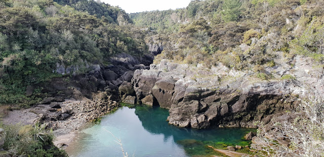
This is looking towards the rapids, as the catchment leading to the rapids starts to fill

The pool is almost full and the excess is starting its journey towards the rapids

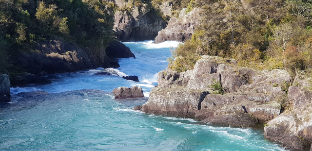
Now full, the rapids are at capacity as up to 80,000 liters a second are heading down a 28-meter drop heading towards the hydroelectric power station.

And once full at the bottom, there is a jet boat ride available for a closer view of the water, and a few thrills to go with it.

Searching for locations: Aratiatia Dam, Taupo, New Zealand

Aratiatia Dam water release, Taupo

The Aratiatia Dam, rapids, and hydroelectric power station are located on the Waikato River, New Zealand’s longest river.  It is about 16km from Taupo, and 6km from Huka falls, and there is a walking track, for the fit, of course, between the two water attractions.

This happens three or four times every day, depending on the season, and lasts about 15 minutes.  Water is released at the rate of about 80,000 liters a second, so it is quite a lot of water being sent through the rapids.

There are a number of viewing points, the most popular being from the bridge, where I took these photos, and 5 minutes down the walking track to the ridgeline where you can get an overview of the river.

This is looking towards the rapids, as the catchment leading to the rapids starts to fill

The pool is almost full and the excess is starting its journey towards the rapids

Now full, the rapids are at capacity as up to 80,000 liters a second are heading down a 28-meter drop heading towards the hydroelectric power station.

And once full at the bottom, there is a jet boat ride available for a closer view of the water, and a few thrills to go with it.

Searching for locations: Hohensalzburg Castle, Salzburg, Austria

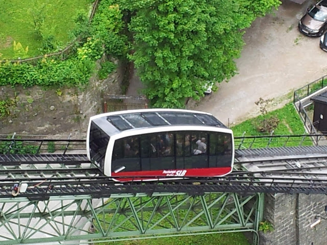
Hohensalzburg Castle sits atop the Festungsberg, accessed by a cable car.

The castle itself dominates the Salzburg skyline.

thecatle

Below is a view down into Salzburg from the castle walls.

We had lunch at a café, the Salzburg Fortress Café, that overlooked the countryside.  This was where we were introduced to Mozart Gold Chocolate Cream added to our coffee.

The square below featured in the Sound of Music.

salzburg1

Among the more interesting objects to be seen, the gun below shows what some of the castle’s armaments might have been.  These cannons, in the ‘Firing Gallery’ date back to the thirty years war in the early 1600’s.

Searching for locations: Hohensalzburg Castle, Salzburg, Austria

Hohensalzburg Castle sits atop the Festungsberg, accessed by a cable car.

The castle itself dominates the Salzburg skyline.

thecatle

Below is a view down into Salzburg from the castle walls.

We had lunch at a café, the Salzburg Fortress Café, that overlooked the countryside.  This was where we were introduced to Mozart Gold Chocolate Cream added to our coffee.

The square below featured in the Sound of Music.

salzburg1

Among the more interesting objects to be seen, the gun below shows what some of the castle’s armaments might have been.  These cannons, in the ‘Firing Gallery’ date back to the thirty years war in the early 1600’s.